
Plan from August 2016 Homepage
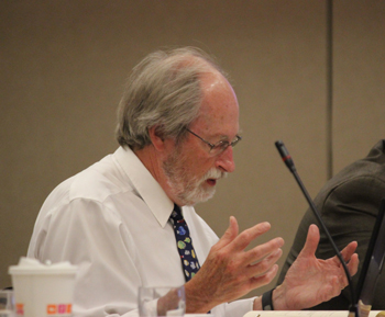
“I attended the listening sessions in Gloucester, Boston, and New Bedford,” said NEFMC member David Pierce. “Few, if any, fishermen were present.” Fishermen’s Voice photo
“In the plan, we need to pay attention to commercial and recreational fishing, and maintain existing maps and data on the portal,” said Pierce. “That’s key. If data are not kept timely, then a lot of good work that’s been done will have been almost wasted.”
Information provided through the portal is not meant to be used as a sole source of information.
“In other words, fishing areas are identified, but [potential developers] have to dig deeper and talk to stakeholders,” said Pierce. “But at least it provides developers with a focus. So it’s well worthwhile.”
“A lot of work has gone into this,” agreed NEFMC member Mary Beth Tooley. “It’s a government-talking-to-government type of deal and the primary purpose is to make sure that all the entities regarding ocean uses are talking to each other and using the best available data.”
Tooley said that one piece of the draft plan gave her pause—the proposed designation of “important ecological areas” (IEAs).
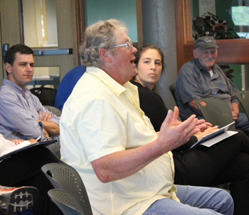
Richard Neklson, lobsterman, Friendship, Maine. “It’s basically a pretty disappointing document in that the agencies don’t identify very many concrete or specific new ways of accomplishing anything with their stakeholders.” Fishermen’s Voice photo
According to the draft, the considering of IEAs is an outcome of the ocean’s plan Regional Planning Body’s (RPB) Ecosystem-Based Management Work Group, convened in September 2015 to review marine life and habitat data referenced in this plan and help develop a regional definition of IEAs, including a framework for using existing data to identify those areas.
But, said Tooley, “That’s not taking existing information and putting it into the portal. That’s developing a new process that seems, on its face, to compete with an existing process, particularly the ones that go on here at this council” with the development of the habitat omnibus amendment. It seems inappropriate.” Tooley suggested the RPB could instead incorporate information from the omnibus amendment. Otherwise, she said, the RPB is only reinventing the wheel.
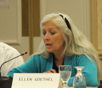
“So if there’s an area that’s being looked at to be developed, the (data) portal will show where those [affected] communities are, and it should be incumbent on them to communicate with those communities that that’s coming up,” said Ellen Goethel, NEFMC member. Fishermen’s Voice photo
“It’s duplicating an effort that’s already taking place in a federal agency,” Tooley said. “I feel they should focus on their core mission. I don’t think this is part of that.”
NEFMC executive director Tom Nies said that, if such areas are developed as part of the ocean plan, it will be important for the National Marine Fisheries Service (NMFS) and NEFMC to determine how such delineations might affect their own planning process.
“I don’t know how they intend to view ‘important ecological areas,’” said Nies. “It might create a hurdle we have to jump over. The flip side is that there could be advantages to having important ecological areas identified in the ocean plan, because it might give more importance to areas we consider important….As staff, we wanted to highlight this as an issue, but we didn’t want to come on too strong, because…there might be benefits going through the process.”
Drew Minkiewicz, an attorney who represents the Fisheries Survival Fund (FSF), said FSF is concerned about the creation of important ecological areas. FSF has been a strong supporter of the ocean planning process, he said.
“We believe there’s value in delineating the uses that are out there and trying to make better decisions,” Minkiewicz said. “The planning process, as far as creating a tool—the portal—that’s all acceptable. But going beyond to these ‘important ecological areas’—that’s where it will get into trouble. All these IEAs are extralegal delineations. There will be a lot of questions about how they were established. And they conflict with already existing authorities.” That includes, for example, essential fish habitats. “This will just confuse that. Say what you will about the habitat amendment, but what you can agree on is that it was done through a public process and is subject to judicial review—none of which is guaranteed with an IEA….And that’s concerning, that you would create an extralegal determination that doesn’t have the same protections of the normal regulatory process.”
Among its draft comments to the RPB on the plan, NEFMC supported that thought, writing, “It is critical that the purpose and use of IEAs be clearly defined so the public understands what impact they may have on future regulatory actions. There should be a clear process for soliciting public input.”
Among other comments to the RPB, NEFMC pushed for greater inclusion of the fishing industry and greater recognition of the cultural importance of working waterfront communities.
“Going forward, the RPB should consider engaging fishermen on the various workgroups,” NEFMC wrote to the RPB.
NEFMC also emphasized the importance of developing additional regional maps and data of commercial and recreational fisheries.
“This is particularly important for the party/charter, recreational, and lobster/crab fisheries for which there currently is only very coarse spatial data about their ocean use activities,” NEFMC wrote. Spatial assignment of fishing activity in this model is only as good as the input data, which do not provide a census of effort as only some permit holders are required to submit federal vessel trip reports. New programs are needed to provide more refined seasonal, spatial information on for-hire, private boat and shore based marine recreational fishing effort.”
NEFMC member Ellen Goethe said the ocean plan should include a requirement that governmental agencies should inform fishing interests and their related coastal communities of any potential ocean development proposals.
“So if there’s a process going on or an area that’s being looked at to be developed, you the portal will show where those [affected] communities are, and it should be incumbent on them to communicate with those communities that that’s coming up,” Goethel said.
John Williamson, Ocean Conservancy’s New England fish conservation manager, said the plan represents an opportunity for NEFMC to elevate its priorities in the management of the environment for the benefit of the fisheries.
“It’s an unusual position for the council to be in,” said Williamson. “But look at the regulations that will come in the future from various agencies beyond NOAA and NMFS, and the activities they’ll be considering in those regulations, and all of the industries and human uses that will be going on, on the Outer Continental Shelf in the future. The fisheries are actually more closely tied to environmental quality than anything else. So your position is the superior position in this regulatory environment, and this plan is your opportunity to elevate your authority and your priorities for the benefit of directing how the regulatory environment moves forward.”
Rick Bellavance, a fisherman from Rhode Island, said it’s important that NEFMC have a significant role with the RPB as a member sitting at the table.
“Most of the processes and agencies that permit different offshore developments don’t allow actual fishermen to sit at the table, so the council is a tool to get the information for the fishermen,” Bellavance said.
Bellavance said that, from a fisherman’s perspective, he’s seen that the planning process can work.
“I’ve witnessed first-hand what proper planning can do, as we entertain new industries that are being considered for the ocean,” Bellavance said. For example, he said, “We had a small wind farm project developed in state waters off Rhode Island. That was shifted a couple of miles to the east to better accommodate fishermen. And the data we provided as fishermen contributed to that decision.”
The data portal, said Bellavance, is an important tool that fishermen can use to participate in the process.
The RPB held a series of public input meetings on the draft plan over the past couple of months. Once comments are incorporated, the plan is expected to head to the National Ocean Council for review.
Getting all human users of the ocean to work well together, without hurting each other or the ocean, about sums up the mission of the new Northeast Regional Ocean Plan (neoceanplanning.org/plan). It’s considered an important new tool for guiding ocean uses.
The plan is an outgrowth of an Executive Order issued by President Obama in 2010. The order built on policy efforts in the previous decade and established an ambitious “national policy to ensure the protection, maintenance, and resto¬ration of the health of ocean, coastal, and Great Lakes ecosystems and resources, enhance the sustainability of ocean and coastal economies, preserve our maritime heritage, support sus¬tainable uses and access, provide for adaptive management to enhance our understanding of and capacity to respond to climate change and ocean acidification, and coordinate with our national security and foreign policy interests.” The President tasked federal agencies, through the formation of regional planning bodies, with the responsibility of developing regional ocean plans.
As a federal executive order, tribal and state participation was voluntary, but New England states and federally recognized tribes have been participating in the process. NRPB, formed in 2012, is composed of representatives from the six New England states, six federally recognized tribes, nine federal agencies, and the New England Fishery Management Council. Over the past four years, the NRPB has combed through reams of data and reports, and solicited input from a wide range of stakeholders and experts toward drafting the plan.
The plan has three goals: healthy ocean and coastal ecosystems; effective decision-making; and compatibility among past, current, and future ocean uses. It doesn’t surpass any existing regulatory authorities, nor does it have regulatory power.
Instead, it proposes the use of data; intergovernmental coordination between federal agencies, tribes, and states; and stakeholder engagement toward meeting the three goals.
The data piece comes in the form of a Northeast Ocean Data Portal, launched in 2010 and viewed as an ongoing receptacle for data and map input that characterize 10 aspects of ocean management and policy that span human activities, cultural resources, and the ecosystem. Those 10 aspects are:
• marine life and habitat
• cultural resources
• marine transportation
• national security
• commercial and recreational fishing
• recreation
• energy and infrastructure
• aquaculture
• offshore sand resources
• restoration
The 10 resources and activities became the focus of the plan because of their importance to the region and the role they play in existing ocean management and policy. The data portal is viewed as an important tool for implementing the plan by providing publicly accessible, expert-reviewed data on human uses and activities for agency and public use.
At the Ellsworth meeting to get public input, held June 21, NRPB member Mel Coté—the U.S. Environmental Protection Agency’s manager of the Office of Ecosystem Protection’s Ocean and Coastal Protection Unit/Region 1—said ultimately the plan is about ensuring compatibility between all uses human and non-human, and avoid the potential for conflict.
Nick Battista, marine programs director with the Rockland-based Island Institute, wanted to know what the plan’s mechanisms were for understanding if uses are compatible or not, particularly with regard to issues related to the fishing industry, which he said is not as well represented in the plan as marine life data or other uses.
Kathleen Leyden, director of the Maine Coastal Program, said the plan doesn’t directly address compatibilities, but more describes the occurrence of resources and activities.
NRPB staffer John Weber said the data portal will help with coordination between agencies and between various ocean users. For example, he said, “When agencies map out where they’re going to go, they need to understand who else will be operating in that area at a given time. It’s that basic and straightforward.” For example, the portal will hold maps and data identifying offshore energy projects, and could also hold information about energy interests applying for permits.
“No one is suggesting the data portal is the be-all and end-all,” said Weber. “It will never be that way. There will always be further studies.”
Several people said the portal should include more historical data, as a better indicator of baseline information from which to measure changes.
NRPB member Rick Getchell, tribal outreach coordinator and former tribal chief with the Aroostook Band of Micmacs, said the plan incorporates a component for paleo reconstruction in order to document human uses going back thousands of years. Getchell said the historical perspective is particularly important in the face of climate change.
Richard Nelson, a lobster fisherman who has been heavily involved in the planning process since it began, although not a formal member of the NRPB, said most of the information in the plan is not new.
“It’s basically a pretty disappointing document in that the agencies don’t identify very many concrete or specific new ways of accomplishing anything with their stakeholders,” said Nelson.
Others also wondered about the plan’s effectiveness, since it lacks regulatory power.
But NRPB members said the data portal is an important new tool for coordinating a massive amount of otherwise disparate information toward the goal of understanding and mitigating impacts on ocean use, which can continually be updated and referenced by the general public as well as by specific stakeholders.