|
Under the Sea, Clues to a Maritime Heritage
by Laurie Schreiber
In 1869, a fierce snowstorm drove the half-bark Aerolite onto Baker Island Bar. The ship was a total loss except for some riggings and sails.
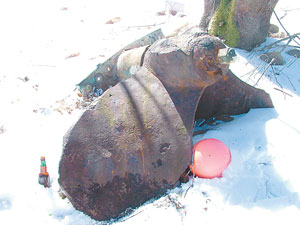
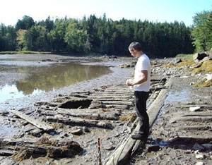
The 2008 assessment, although of limited scope, “opens a window into the possibilities for study that these shipwrecks provide,” the report says. “The wealth of material, the diversity of the sources, and the centuries of history involved illustrate the great potential that this resource has for education, archeology and research.” Price and his colleagues found evidence of 155 wrecks scattered throughout the study area. Sources included historical societies, local libraries, maritime material from the Fogler Library at the University of Maine at Orono, museums, the Maine Bureau of Parks and Lands, the United States Coast Guard, Acadia National Park’s William Otis Sawtelle Collections and Research Center, NOAA’s list of wrecks and obstructions, the publication Merchant Vessels of the United States 1908-1978 and 1981, the Mystic Seaport Museum’s digitized collection of vessel registries, American Lloyds to 1900 and the American Bureau of Shipping to 1900, shipping lists, Captain’s Protests, receipts, correspondence, and U.S. Lifesaving Station correspondence. Contemporary newspapers were the most fruitful source of information. Under headings such as “Marine Journal” and “Marine List” in the 1800s, local newspapers routinely listed maritime disasters on the local, national, and international levels. Sometimes wrecks were reported as paragraphs in state, county, or town happenings, which would mean researchers would have to read the entire newspaper. The team also interviewed local residents, especially commercial fishermen. Ten people offered information on 20 potential shipwreck or abandonment sites, anchors, and historic dump sites. Price dove on several of the sites. “It’s not what you would expect,” he said. “It might be a few ribs, or a keel.” There could be any number of boats that sank but were obliterated over the centuries by storms and the harsh shoreline, and will remain forever unknown. “The wildly destructive nature of the ocean along this rocky coast could easily batter a wreck and sweep away the pieces,” the report says. Still, the report adds, some larger artifacts, such as iron or steel machinery or anchors, are less likely to move far. Artifacts may also find their way into the rocks, and be trapped for long periods of time. As a result, the report says, the rocky parts of the coast may still hold small enclaves of maritime debris. The wrecks mostly involved trading vessels early on, then yachts and fishing boats in the 20th century. Many of the trading vessels were from Canada, still a British colony, that were sailing from Nova Scotia and New Brunswick to Boston, and were blown off-course to crash into Maine’s islands and ledges. The historical record illustrates the changes in ship design, from brigs and barques to schooners, to motorized vessels. “Many fishing boats may have gone unrecorded,” he said. Unlike the star-quality Black- beard type of shipwreck, Maine’s are “more mundane,” Price said. “These were the workhorses, bringing goods from place to place,” he said. “But any wreck can tell you about life at the time. To me, they’re all of interest.” Even a single part of a ship, such as the keel, can yield useful information, he said. “Especially in the 1700s and before, there are holes in our knowledge about ship construction,” he said. “So this data would help us learn more about shipbuilding in general.” It is not uncommon for local fishermen and divers to come upon artifacts, hauled up in their nets, sitting on the sea floor, or washed onto shore. A hawse-pipe ashore and some keel lead might be artifacts of the Nellie J Crocker of Calais, wrecked on Schoodic Island in a thick fog. One informant reported bringing up part of a keel in his scallop drag. Another saw a partially buried hull structure off Ship Harbor while diving. Fishermen reported dragging up artifacts off Baker Island that included an anchor, an old hauling block, propellers, and a prehistoric artifact. Submerged material near Long Ledge including a sunken anchor, and timbers with brass fasteners, could be from any of the vessels that met disaster there—the brig Ava in an 1860 snowstorm, the schooner Amaranth grounded in 1868, the schooner Burpee C in 1892, the schooner Agnes in 1907, the Ida M in 1904, or some undiscovered or forever unknown ship. Price stresses that artifacts on wrecked vessels are not up for grabs because the state owns historic vessels, while more recent wrecks belong to the original owner or the insurer. Maine is not a state that issues treasure-hunting permits. For Price, the work is both an adventure and a glimpse of history. “It’s exciting work,” said Price. “It’s the sort of thing that’s fascinating.” The work, he says, helps to raise public awareness not only of the history of wrecking events in general but of the rich maritime history of this part of the Maine coast. “This is something that’s not just in the past,” he said. “It’s part of a heritage.” |